Water Quality
Preserving the integrity of our marine environment
What is water quality and why is it important?
Water quality is defined in terms of the chemical, physical and biological properties of water. Water quality can be affected in many ways, often by nature’s own processes, but also by human activities occurring in and adjacent to it. Poor water quality can adversely affect human and ecosystem health.
PRPA’s Marine Environmental Water Quality (MEWQ) program provides an understanding of the state of the water in the Prince Rupert harbour and surrounding area. By knowing the condition of the water and the processes and activities that affect it today, PRPA can make effective management decisions to ensure the integrity of this critical resource now and into the future.
How is water quality measured?
PRPA’s MEWQ program involves many regional partners and stakeholders that contribute to program costs such as sample analysis and reporting. PRPA’s environmental team conducts water quality monitoring in two ways – by collecting monthly in situ (or “on site”) measurements as well as quarterly water samples that undergo laboratory analysis.
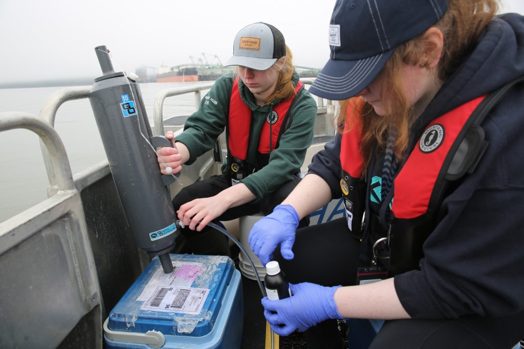
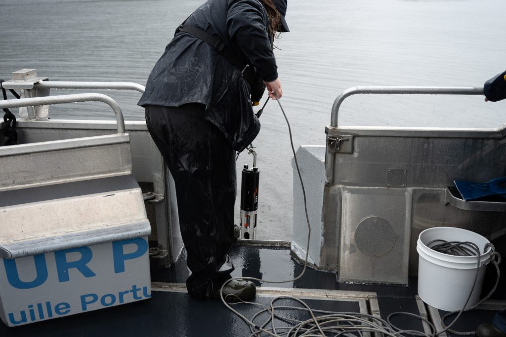
Quarterly water sampling involves collection and analysis of discrete samples collected at 24 sites throughout the Prince Rupert harbour and surrounding area using a Niskin sampler. These samples are analyzed for parameters including turbidity and total suspended solids, nutrients, metals, phytoplankton abundance (via chlorophyll a concentrations), bacteria, and hydrocarbons. Monthly in situ “depth profiles” are also taken of other common parameters such as dissolved oxygen, temperature, and salinity, using an AML-6 CTD (conductivity, temperature, depth) instrument, and alongside the quarterly sampling at the same 24 sites. The instrument is slowly lowered through the water column to each site’s maximum depth as it records measurements of each parameter.
Ocean Networks Canada
Community Fishers Program
PRPA partnered with Ocean Networks Canada’s Community Fishers Program in January 2024 to establish more frequent and robust in situ oceanographic data collection. This program focuses on community members collecting baseline oceanographic data using an AML instrument, with the purpose of understanding water properties and ecological trends in coastal regions. The program involves QA/QC and processing of all depth profile data, publicly available high-resolution depth profile images uploaded to their geospatial map as well as additional data products. Some examples are shown below. Depth profile data collected since January 2024 is publicly available and can be viewed through Ocean Networks Canada’s Community Fisher’s geospatial map.
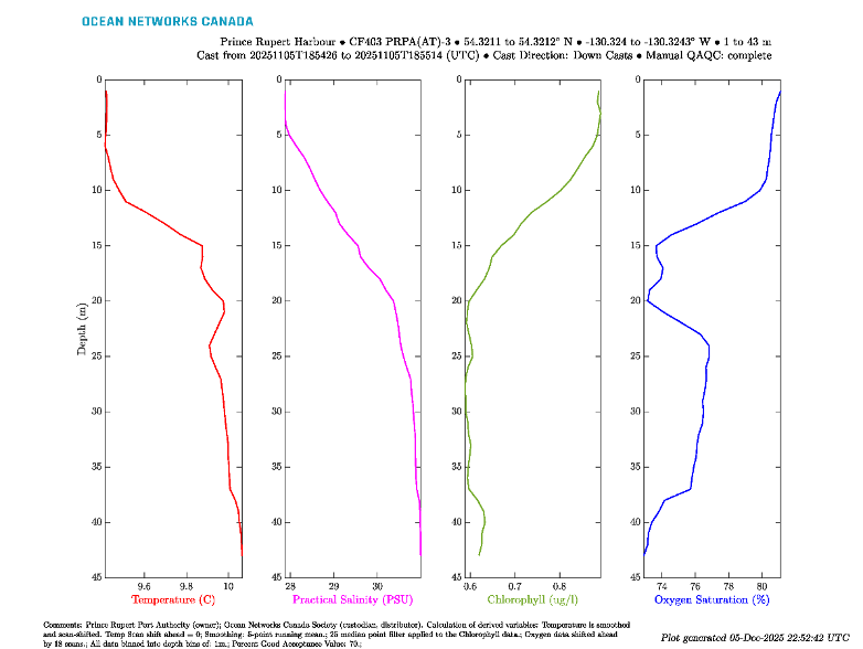
Example of temperature, practical salinity, chlorophyll and oxygen saturation depth profile plots generated by Ocean Networks Canada’s Community Fishers platform at Site 3 on November 5th, 2025.

Seasonal differences in temperature, practical salinity, chlorophyll and turbidity at all sites

Salinity depth profiles at Site 34 from January 2024 to October 2025.
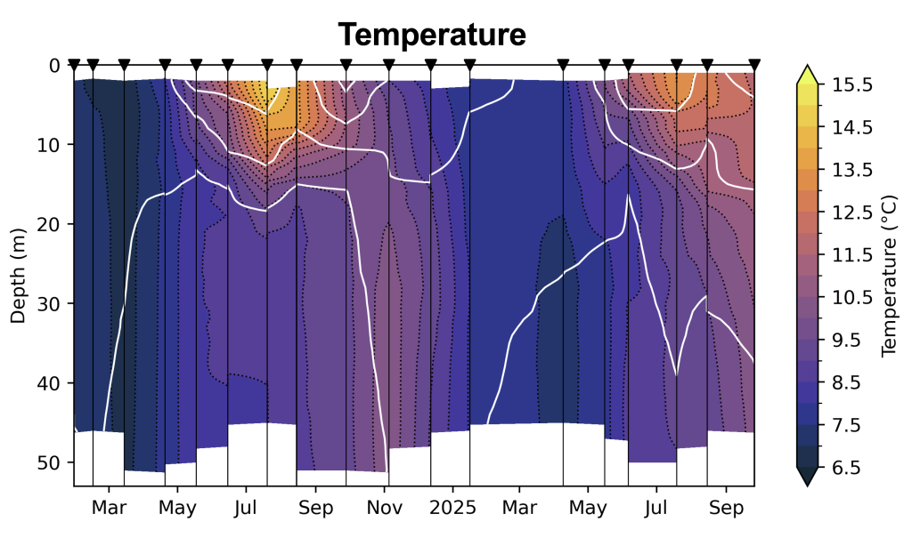
Temperature depth profiles at Site 34 from January 2024 to October 2025.
Underwater Observatories
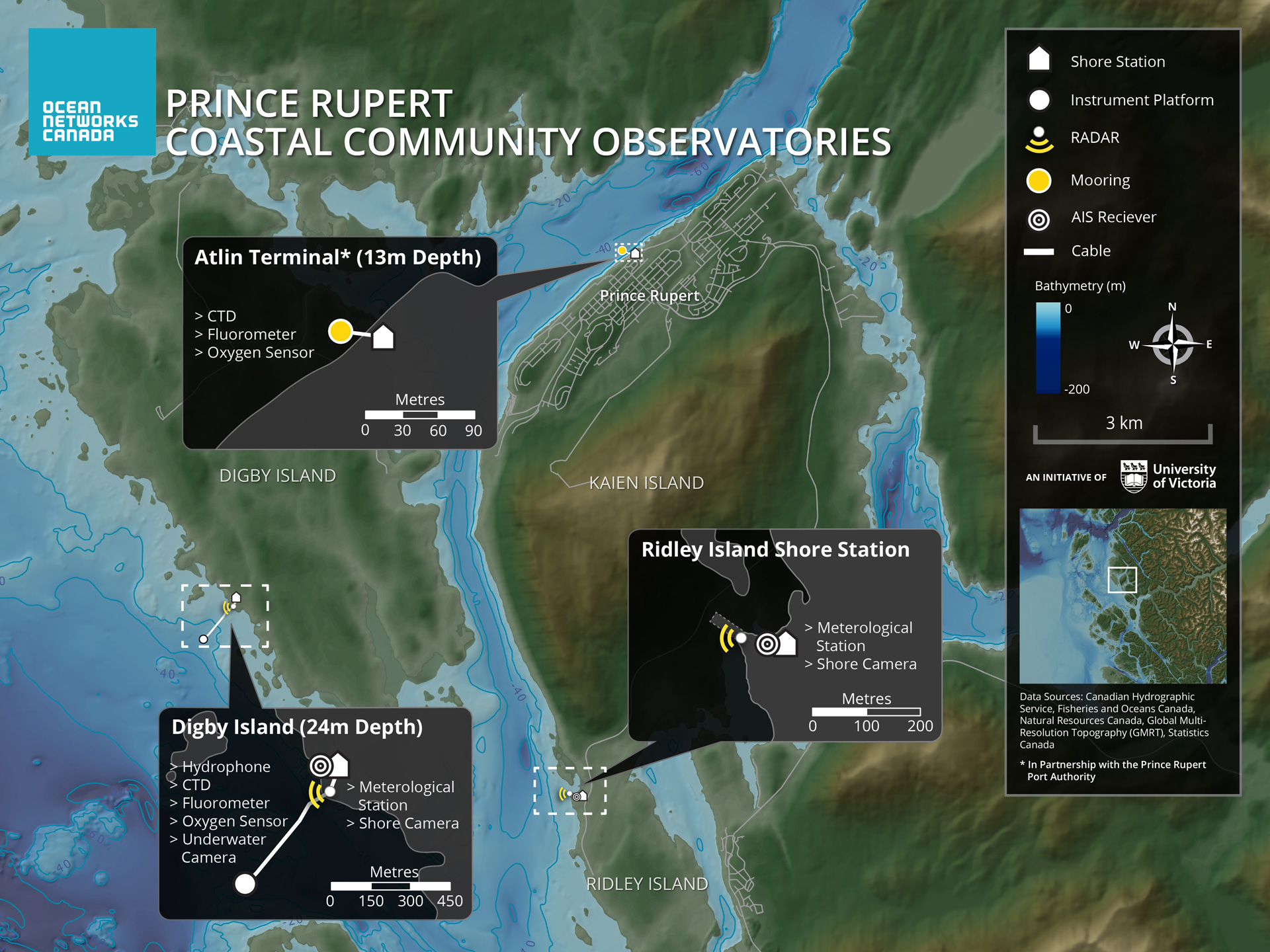
In addition, water quality is measured real-time at two underwater observatories – Digby Island and Atlin Terminal – established in 2017 and managed by Ocean Networks Canada (ONC). Data can be viewed on the Oceans 3.0 platform here.
How are water quality measurements interpreted?
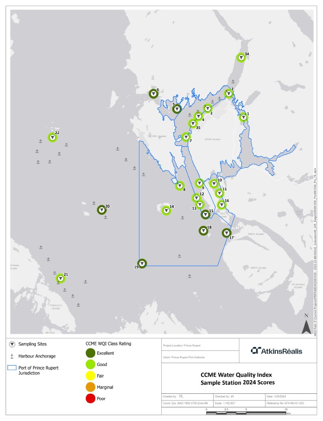
For reporting purposes, water quality results are compared to standards developed by both the federal and provincial government. PRPA also utilizes the CCME Water Quality Index to categorize annual results for each site as ‘excellent’, ‘good’, ‘fair’, ‘marginal’, or ‘poor’. The map below shows the most recent Water Quality Index scores for each site in the program.