Shoreline & Biodiversity Monitoring
What is shoreline habitat and why is it important?
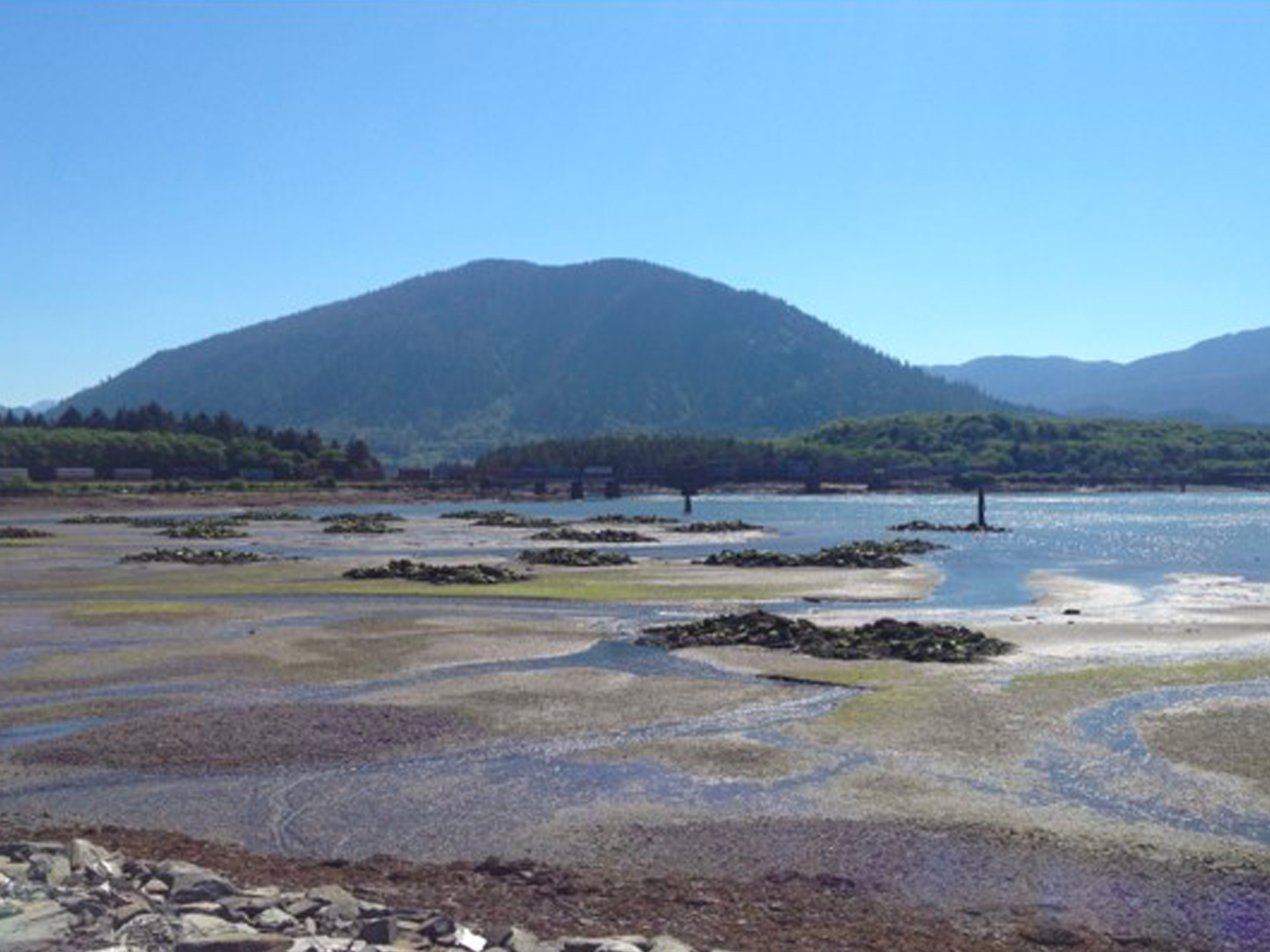
Shoreline ecosystems are unique areas greatly influenced by tidal patterns, human uses, and neighbouring estuaries and wetlands. Shorelines are defined as the general area of land bordering a body of water, but more specifically, the intertidal zone is the area between high and low tide. Intertidal habitats can be a mixture of substrates and support a great diversity of life including many species of invertebrates such as crabs, snails, limpets, mussels, chitons and sea stars, as well as many species of seaweeds including rockweed, Turkish washcloth, sea lettuce, laver, and sugar kelps. Intertidal habitats are home to many species that are vital to marine ecosystem health. Filter-feeders such as mussels and barnacles help maintain healthy water quality and organisms such as crabs consume dead materials and contribute to maintaining a clean and healthy habitat. These sensitive ecosystems can be negatively impacted by both natural processes and anthropogenic (human) activity. Regular monitoring of these environments is required to understand current ecosystem health and assess any significant changes that may occur in the future.
How are intertidal ecosystems monitored?
Intertidal Biodiversity Surveys
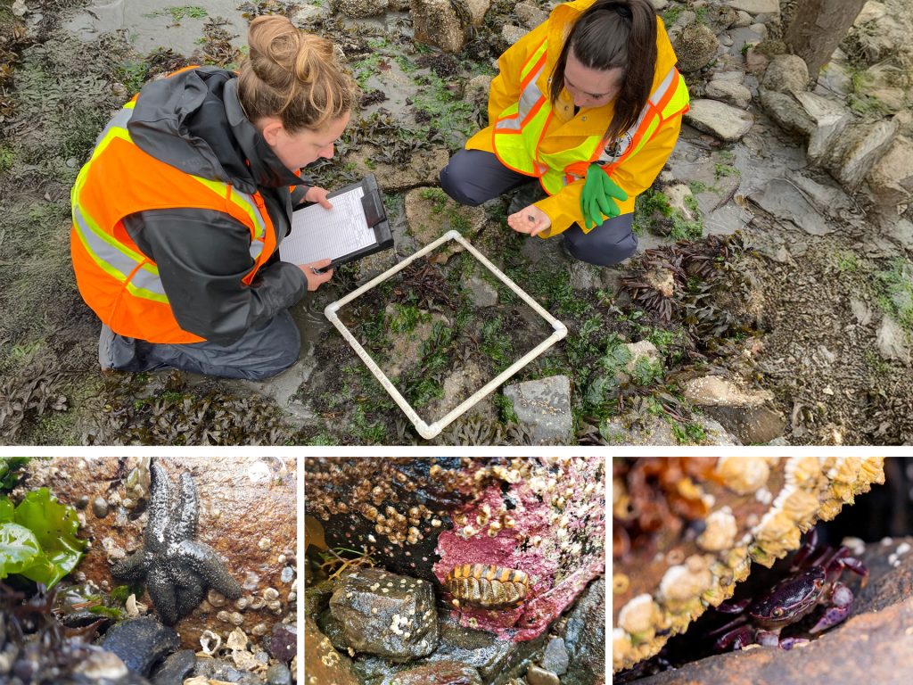
Intertidal organisms are naturally resilient to environmental fluctuations, as they are continuously exposed to wave action and extreme changes in temperature, moisture, and salinity. Despite this, intertidal organisms and their habitats are still sensitive to significant changes in their environment, particularly impacts from human activity such as habitat destruction, pollution, and decline in water quality. To gather baseline data on local intertidal ecosystems, PRPA has been conducting annual intertidal biodiversity surveys at a variety of locations in the area since 2017, using the transect-quadrat method. These surveys involve recording the species present and their count or percent cover along a plotted area at several intertidal sites on both Kaien and Ridley Island. Species richness, abundance and diversity are then calculated and compared among sites and over time. Baseline data is used to understand current ecosystem condition and relative productivity of each area and can be used to assess any impacts from future development or other activities that could affect the health of these important ecosystems.
Three Amigos Program
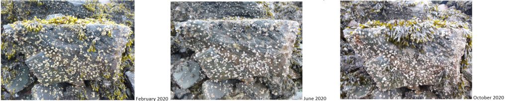
The Three Amigos Program was established in 2017 and uses the simple method of photo-documentation to monitor and describe ecological changes in local rocky intertidal areas over time. This monitoring program focuses on analyzing specific areas of the intertidal (usually a distinctive boulder) for the presence of rockweed, barnacles, and mussels (the three amigos) and the changes in their growth and abundance over time. Photos of each monitoring site are captured frequently and are compared by looking at both seasonal and annual differences in the species composition. The data collected helps to better understand the condition of rocky intertidal communities and the natural variation in the presence and abundance of the ‘three amigos’ over space and time. This monitoring program will also help assess impacts due to disturbance such as development or oil spills.
Successful Habitat Compensation – Artificial Reefs in Porpoise Harbour
In 2014, 40 artificial dumbbell-shaped reefs were constructed in Porpoise Harbour as compensation for habitat loss due to the construction of the Road, Rail and Utility Corridor (RRUC) on Ridley Island. The reefs were required to be monitored annually for five years to evaluate the establishment and growth of marine organisms. The compensatory habitat was also required to meet success criteria after five years, including being used by a diverse assemblage of marine biota consisting of CRA (culturally, recreationally and aboriginally important) species, as well as having equivalent to or greater diversity and abundance of marine organisms than nearby reference sites. In 2019, this compensation habitat was deemed successful by Fisheries and Oceans Canada. PRPA continued to monitor the reefs annually from 2020-2024 to collect additional data on the species present, as well as sedimentation and general structural integrity of the reefs. An abundance of species can now be found inhabiting the reefs, including several crab species, mussels, sea stars, laver, various kelps, chitons, and sea pens, as well as shrimp, rockfish, perch and juvenile salmon. Eelgrass was also observed at several locations surrounding the reefs, which were also monitored from 2017-2024.
How is shoreline habitat monitored?
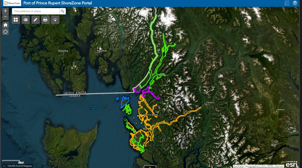
ShoreZone
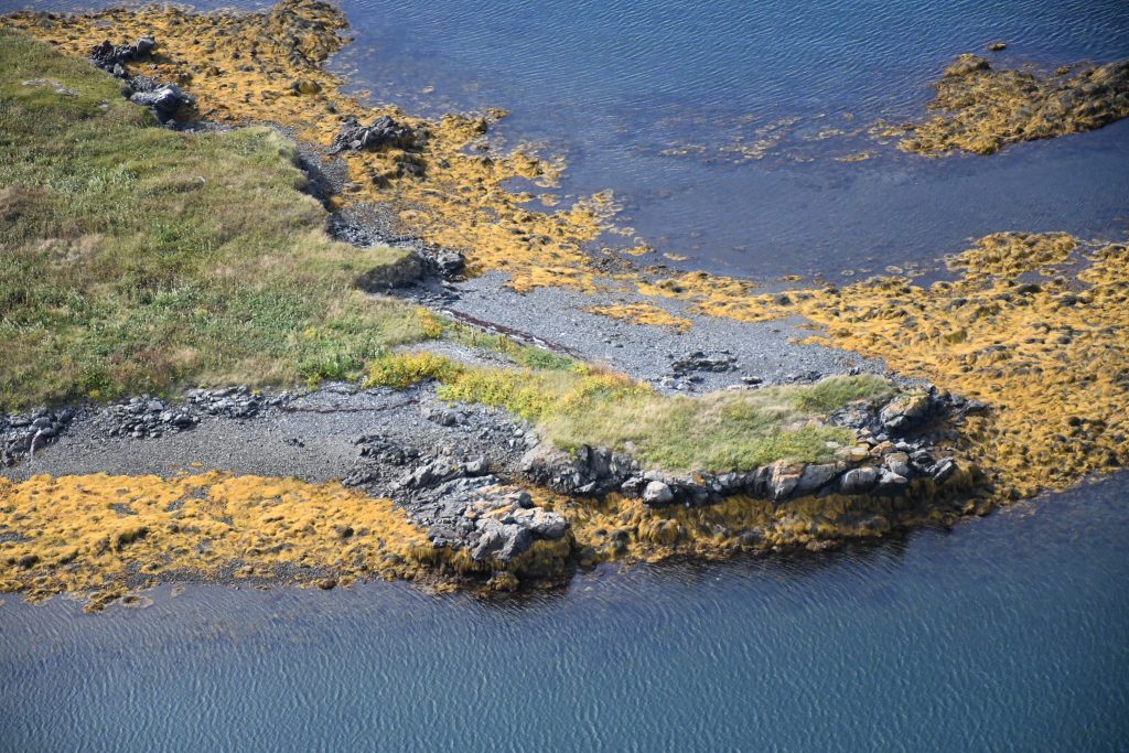
PRPA has worked with key partners to document existing shoreline habitats around Prince Rupert, the Tsimshian peninsula and the Skeena River using very high-resolution aerial imagery. The photographs and videos of hundreds of kilometres of shoreline were taken while flying several hundred feet over the ground, and spatially referenced by a global positioning system so that accurate latitude and longitude information can be determined for any location in the photo. Lastly, the images are stitched together to create a coastal survey map.
This program will be repeated on a cycle subject to the amount of change that is caused by human or natural forces.
In addition to monitoring, this information can also be critical for response to natural and manmade disasters. The data in these photos can provide emergency and coastal managers with information needed to assess damage, but also to develop recovery strategies, facilitate search and rescue efforts, and identify hazards to navigation and hazardous material spills.
The ShoreZone Imaging Survey was funded by the Prince Rupert Port Authority, Pacific Northwest LNG, Aurora LNG, the Gitxaala Nation, the Metlakatla First Nation, the Nisga’a First Nation, as well as BC Ministry of Environment.
Additionally, ShoreZone mapping is available through the Port of Prince Rupert ShoreZone Portal and dedicated ShoreZone imagery is available on Flickr.